
Trace Hampton Streets by Address
Use a complete street number and street name first. The Hampton Assessor directs property searches to CivQuest, where an address can be tied to a parcel, its legal description, assessment information, and transfer history. That establishes a property record, not a current household. Save the parcel or property ID and the situs address before moving to another source, because a name, mailing address, and street location can point to different things.
For a by-address search, work from the stable parcel record outward. A city map can show which parcels touch the same segment, the Clerk can connect an owner to a recorded instrument, and a historical directory can supply a dated listing. The voter route is separate and restricted by Virginia law. It should be used only through the authorized status tool or a lawful request channel, never as an open street-by-street name search.
- Enter the address in Hampton CivQuest and record the situs, parcel ID, legal description, and current owner or taxpayer field if shown.
- Open the parcel on the map and compare its boundaries with adjacent polygons. Corner lots, rights-of-way, and water features can make sequential street numbers misleading.
- Use the parcel ID or legal description to find the recent transfer row, then verify that lead through the Hampton Circuit Court Clerk’s recorded-land index.
- For voter information, use the Virginia Citizen Portal only for the voter or an authorized user. A qualifying public-list request follows a different statutory process.
- For an older address, check the volume’s reverse or criss-cross portion if it has one, then pair the printed street label with the deed, map, and census period.
Note: A street address starts the search, but the parcel ID and legal description are the stronger keys when names or street labels change.
Hampton Street Directory Parcel Fields
Hampton’s older Parcel Viewer is a useful field guide, even though the city says the legacy viewer is outdated and directs users to CivQuest. Its parcel-card model identifies the tabs a street search should preserve: General, Improvements, Transfer History, Assessments, Tax Information, City Resources, Scanned Documents, and Crime Statistics. General may hold assessment neighborhood, class, legal description, subdivision number, and photo; other tabs can add building facts, sale dates, values, or city-resource links. The fields vary by parcel, so an empty tab is not evidence that a record never existed.
Use the narrowest control that answers the question. Address fields locate a property, owner-name fields need confirmation against the parcel, and map selection is useful when a street number is uncertain. The captured city and ArcGIS controls below describe the inputs rather than promise that every control appears in the same way on every device.
| Hampton search control | Input | Street-search use |
|---|---|---|
| Street number | Required numeric text after terms acceptance | Pairs with the city-matched street name in Services for My Address. |
| Street name | Required autocomplete text | Select the city result rather than a manually guessed variation. |
| Address or street | Text or autocomplete | Starts a parcel search in the property workflow. |
| Owner name | Text | Check surname and given name separately, then verify the address and legal description. |
| Parcel or property ID | Exact text | Links the map, transfer PDFs, and parcel detail more reliably than a street label. |
| Where / Text | Optional ArcGIS query text | Constrains a Parcels_RM query to a known address or parcel value. |
| Geometry and spatial relationship | Optional map controls | Finds parcels that intersect, contain, or sit within a selected street area. |
| Out Fields and return options | Optional field and result controls | Requests only needed fields, IDs, geometry, counts, or extent. |
The Hampton parcel-query interface displays the field, geometry, output, and result controls used for a focused GIS query.
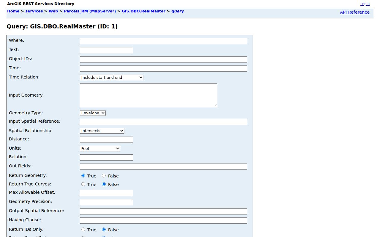
Those controls support a parcel-level inquiry. They are not an instruction to collect a broad street list, and the service’s selection and record limits should be respected.
Browse Hampton Streets on GIS
After selecting the target parcel, inspect its geometry and the immediately adjoining polygons. City Services for My Address asks for a street number, a matched street name, and terms acceptance before returning address-linked information. CivQuest and the GIS layers can then add neighborhood district, precinct, zoning, service information, ZIP polygon, and nearby parcel context. A parcel boundary is useful for seeing how a street segment is laid out, but it is not a legal title determination or a postal-delivery decision.
Compare the situs address with the legal description before treating two results as the same place. A street corner can touch more than one road, and a mapped right-of-way or water polygon may not represent a neighboring private parcel. For an address-history question about an old lot, keep the subdivision, plat reference, and parcel ID alongside the printed address. That record trail survives a change in spelling, postal label, or numbering better than a street-name match alone.
Hampton Street Address Records
Each address-keyed source answers a narrow question. The assessor record identifies a tax or ownership connection, GIS gives spatial context, and a recorded instrument documents a transaction. Historical directories can place a named householder at a printed address for one period. None of those sources, alone or together, creates a complete current list of people on a street.
| Address source | Local holder | Useful signal | Important limit |
|---|---|---|---|
| Assessor and CivQuest parcel | Hampton Assessor | Parcel, situs, owner or taxpayer, assessment, legal description | An owner is not automatically an occupant. |
| GIS parcel service | Hampton GIS | Parcel geometry, street layout, nearby parcels, ZIP and district layers | Mapped geometry does not establish title or delivery status. |
| Property transfer PDFs | City of Hampton | Property ID, address, grantor, grantee, class, date, amount | A transfer row is a lead, not the recorded deed. |
| Land Book | Assessor and Circuit Court Clerk | Annual parcel owner, assessment, and tax record | Annual value does not establish a household. |
| Recorded land instruments | Hampton Circuit Court Clerk | Parties, date, book or document number, legal description | Remote image access can be limited. |
| Voter record or list | Hampton Registrar | Lawfully available registration and district information | Use and copy rules are controlled by statute. |
| Permit and inspection maps | City of Hampton | Address, record type, date, or status where public | An applicant is not proof of residence. |
The parcel ID is the practical bridge across this address-record chain. It ties an address to the transfer PDF and supports a targeted Clerk or GIS inquiry. The street name is still valuable for walking the map or reading a directory, but it needs the parcel and legal description beside it.
Read Hampton Transfer Rows
The city’s Property Transfers page publishes calendar-year PDFs for 2020 through 2026. A row can supply a property ID, address, grantor, grantee, property class, transfer date, and amount. That makes it a helpful recent-owner-change index for a known Hampton address. Before recording a conclusion, carry the property ID and parties into the Clerk’s land-record index and compare the deed’s legal description with the selected parcel.
For land-record access, the Virginia SRA/COVERS service warns that its database is not the official record. Image access may depend on a clerk-authorized subscriber agreement and payment, and the exact online coverage for Hampton should be confirmed with the Clerk. A blank online result can mean an access or coverage issue, not that no instrument was recorded.
The city transfer landing page shows the calendar-year route that starts this verification.
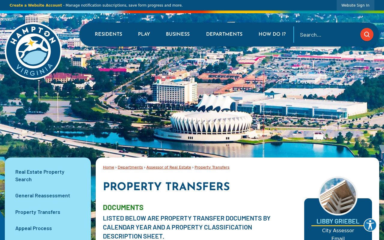
Use the row to locate the instrument, then preserve the document number or book and page with the parcel key. That is more durable than keeping a name alone.
Hampton Street Directory Terms
Street research becomes less error-prone when the property terms remain distinct. Hampton’s independent-city government now holds current records, but earlier material may use Elizabeth City County, Phoebus, Old Point, or Kecoughtan. Retain the wording from the original record and add the modern Hampton context in a note rather than overwriting the historic label.
- Parcel
- A mapped unit of real property with its own identifier. It is the best bridge from a street address to assessment and deed material.
- Situs address
- The physical location of the parcel or building. It differs from a tax mailing address, which can belong to an owner somewhere else.
- Plat
- A recorded map or survey showing lots, lines, roads, or subdivisions. It can clarify an old street segment or lot boundary.
- Criss-cross directory
- A reverse-address arrangement that may list an occupant or householder by street. Verify that the particular historical volume includes one.
Hampton Street Directory History
For historic street context, the Hill directory run begins in 1897-1898 and has near-consecutive volumes through 1920, followed by 1923, 1925, 1927, and 1929. A 1944-45 catalog title also includes Hampton-area places. The FamilySearch Hill catalog records title changes that matter to a street search: Phoebus, Old Point, and Kecoughtan are now within Hampton, while Hilton Village is in modern Newport News.
Maps help test whether an address and a directory entry describe the same built place. The Library of Congress 1916 Hampton Sanborn set has 42 sheets and can show a building footprint, use, adjoining structures, and period street context. It does not name an occupant, so use it with a dated directory or deed rather than as a people record.
Note: Hampton’s 1952 consolidation makes historic jurisdiction and place labels part of the search evidence, not mere spelling variations to discard.
Hampton Street Numbering Rules
Hampton’s street naming and addressing policy supports GIS and emergency location. As numbers increase, even numbers are generally on the right and odd numbers on the left. A residential address is based on the front door or main entrance to the street at permitting; an apartment adds its unit identifier, and principal uses in a duplex can have separate addresses. Those conventions help explain modern placement, but they should not be imposed on an older directory entry without checking the period source.
A vacant lot normally does not receive an address until a site plan or building permit, though an LRSN can serve as a reference. For a Hampton street directory search that reaches a vacant or redeveloped lot, preserve the parcel ID, legal description, and plat instead of assuming a missing street number means the property disappeared.
Request Hampton Street Records
When a public map or posted PDF does not answer a narrow property question, ask for an existing record by parcel ID, street segment, record type, and date range. Hampton accepts requests through its FOIA process, including GovQA and other listed channels. Virginia FOIA generally requires a response within five working days, subject to permitted extensions and actual reasonable costs. A focused request for an existing transfer, permit, inspection, or GIS export is more likely to match a record already maintained by the city.
FOIA does not require Hampton to create a new street directory or assemble a person list from separate databases. The voter statutes also control voter records independently, so a general records request cannot expand the lawful access categories in Virginia Code §24.2-405.
Hampton Street Directory Limits
A Hampton street directory can document a parcel owner, a recorded party, a dated historical listing, or a lawfully available voter record. It cannot prove that every person connected to an address lives there now. Tax mailing addresses may be outside the city, deed parties can be trustees or estates, and a directory’s householder entry is only a snapshot. Protected addresses and restricted voter information also remain outside a general street search.
For a house-history question, describe each result by what it actually shows: owner, recorded party, printed householder, map context, or lawful registration record. That practice avoids turning fragments from different dates into a false current profile.
Lawful use. Hampton address records are appropriate for personal research, family history, property context, and civic questions. Do not use any result to stalk, harass, intimidate, or harm another person.