
Hampton ZIP Code Coverage
Hampton's official GIS ZIP layer exposes ten mapped ZIP values: 23605, 23651, 23661, 23663, 23664, 23665, 23666, 23667, 23668, and 23669. That is a city-map inventory, not an assertion that all addresses in a mapped polygon share one delivery pattern or legal boundary. USPS remains the delivery authority for a particular mailing address. Hampton's own research notes that exact branch or coverage information was not located in official city sources for several of these values. Those unknowns should stay visible rather than being filled with a guessed station name.
| ZIP | Areas Covered | Post Office | Notes |
|---|---|---|---|
| 23605 | Polygon touching the Hampton map | Exact branch not located in official sources | Boundary ZIP; validate the specific address. |
| 23651 | Fort Monroe and Old Point map context | Exact branch not located in official sources | Historic place labels can differ from current labels. |
| 23661 | West or south Hampton; Wythe and West Hampton examples | Wythe, 405 Chesterfield Road, Hampton 23661-9998 | Use address validation, not the polygon as a people list. |
| 23663 | Phoebus, North Phoebus, and downtown waterfront context | Phoebus, 102 E. Mellen Street, Hampton 23663-9998 | Phoebus and Old Point names remain useful search terms. |
| 23664 | Fox Hill and Buckroe context | Current branch not located in official sources | Compare district context with the parcel map. |
| 23665 | Langley Air Force Base context | Langley AFB, 62 Walnut Avenue, Hampton 23665-9998 | Institutional delivery requires USPS confirmation. |
| 23666 | Aberdeen, Magruder, Todds Lane, and central-west context | Riverdale, 1062 W. Mercury Boulevard, Hampton 23666-9998 | Compare the polygon with actual street location. |
| 23667 | Institutional and central Hampton map area | Specific current branch not located in official sources | Use as a map filter, not a complete public-person roll. |
| 23668 | Hampton University and downtown context | Specific current branch not located in official sources | Precinct geography can change separately from ZIP geography. |
| 23669 | Central and Old Hampton; city administrative context | Old Hampton, 89 Lincoln Street, Hampton 23669-9998 | Separate an office mailing address from a parcel situs. |
Hampton's map helps with geographic context. USPS confirmation answers a different question: whether a specific address has a valid mailing city and ZIP. A city address may use a postal label that is not its legal locality, while a polygon can cross a municipal edge. Mark uncertain results “verify with USPS and city GIS.”
Hampton GIS ZIP Code Layer
The official Hampton source is the CQ_Int1 MapServer layer 2, named Zip Codes. It is a polygon layer with a field called ZIPCODE. The service supports a query and, where enabled, JSON or GeoJSON output, advanced and statistical queries, and a maximum record or selection setting of 2,000. Geometry is the key limitation. A query can identify a ZIP polygon or addresses and parcels selected from it, but it does not create a current resident list. Begin with the ZIPCODE value, then pivot to an individual address in CivQuest or the Assessor route.
| Layer | CQ_Int1 MapServer layer 2, the Hampton ZIP polygon layer. |
|---|---|
| Geometry | Polygon geometry, suitable for map selection and boundary context. |
| ZIPCODE | The field that exposes the Hampton ZIP values in the layer. |
| Query output | Use documented query controls; JSON or GeoJSON may be available where enabled. |
| Result limit | The layer publishes a maximum record or selection setting of 2,000. |
View the official Hampton ZIP layer to inspect its published fields and current service behavior.
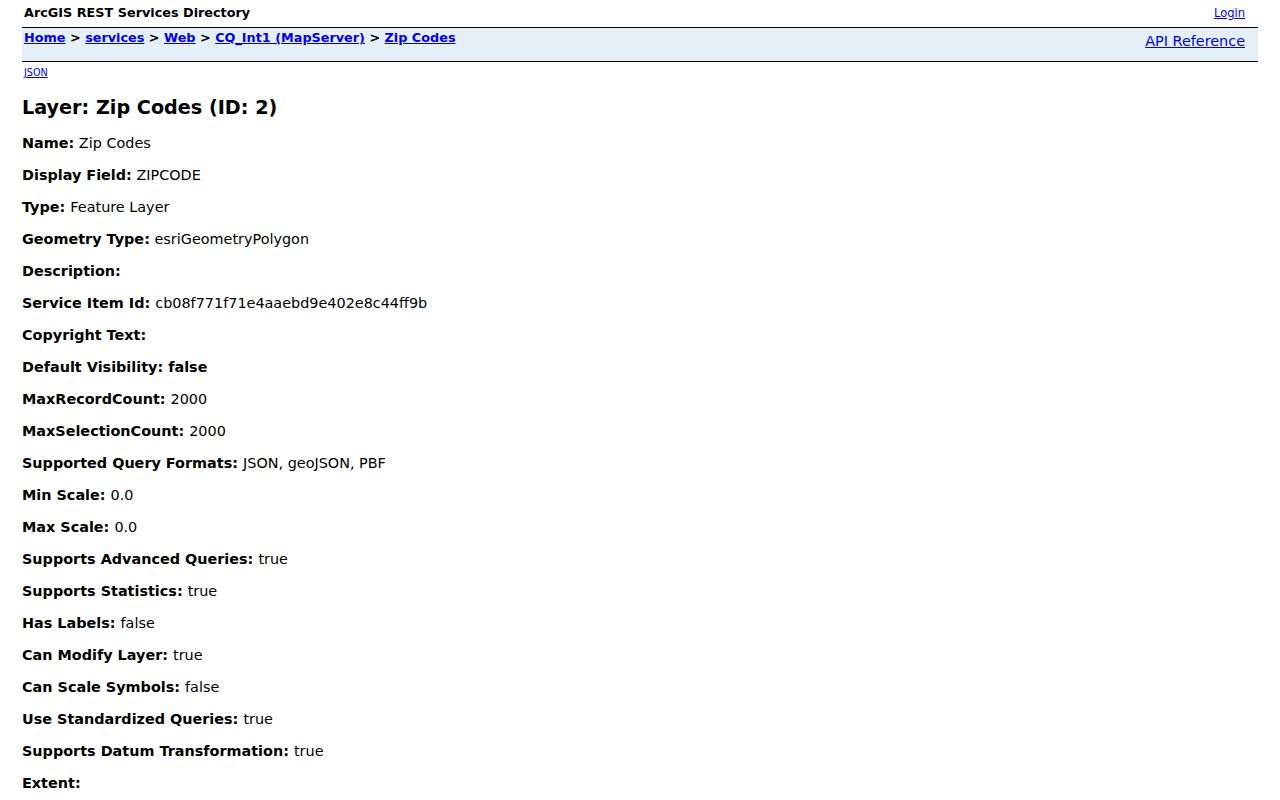
The layer view documents the ZIPCODE field and the polygon-based method behind Hampton ZIP searches.
Search a Hampton ZIP Code
Use a Hampton ZIP as a narrowing tool, then verify each address independently. The Assessor and CivQuest route is designed for a street address, owner name, or parcel or property ID. The legacy parcel help identifies expected tabs such as General, Improvements, Transfer History, Assessments, Tax Information, City Resources, Scanned Documents, and Crime Statistics, but the current CivQuest front end can change. Property data can describe an owner or parcel. It does not prove who lives at the location.
- Confirm the mailing ZIP for the full Hampton address through the USPS ZIP Lookup Tool.
- Use the city ZIP polygon to see the Hampton map context and save the ZIPCODE value.
- Move one address at a time into CivQuest or the Assessor search, preserving the parcel ID and situs if shown.
- Use Services for My Address for city-resource, district, precinct, and service context after selecting the address.
- For historical work, map the current street to its older place label before consulting a directory or Sanborn sheet.
Virginia's Citizen Portal is for a person's own or authorized voter record. It is not a ZIP-wide arbitrary-person search. Public voter-list requests are governed by statutory requester and use limits, including Virginia Code §24.2-405. For a named street after the ZIP has been narrowed, use the Hampton by-street directory and its address-first workflow.
Open the Hampton GIS and maps page for the current city entry point.
The city GIS page connects the ZIP map to the current public Web GIS resources rather than the retired parcel viewer.
Hampton Addressing and ZIP Codes
Hampton's street naming and addressing policy supports GIS and emergency location. As numbers ascend, even numbers are generally on the right and odd numbers on the left. For a dwelling, the front door or main entrance guides the address at permit; a commercial address uses its main entrance. Apartments use the street address plus an apartment identifier, and principal uses such as duplex units can receive separate addresses. These rules explain why a map label and a mailing line need to be read carefully.
Hampton's standards took effect July 1, 2011 and were revised July 4, 2014. A vacant lot is normally not assigned an address until a site plan or building permit; its LRSN can be a reference meanwhile. Keep the parcel ID and legal description when comparing Hampton address records. A historic street may also have a renamed, renumbered, postal, or consolidation context that an ordinary ZIP field does not show.
Hampton ZIP Boundaries and Districts
Hampton ZIP polygons, municipal limits, parcels, voting precincts, and neighborhood districts are separate boundary systems. A ZIP may touch or cross a city edge, while an address can use a postal city that differs from its legal locality. The city district layer has ten neighborhood concepts: Northampton, Magruder, Mercury Central, North King Street, Fox Hill, Buckroe, Phoebus, Downtown, Greater Wythe, and Aberdeen. None is a ZIP name or a substitute for address validation.
Those distinct labels are useful for a Hampton map search. For example, Fox Hill and Buckroe give context to 23664, Phoebus relates to 23663, and Greater Wythe can assist with 23661. The associations are map and neighborhood clues, not exact delivery definitions. On a Hampton research note, keep the Hampton mailing result, Hampton ZIP polygon, Hampton parcel ID, Hampton situs, and Hampton district separate. Use the current postal result for mail, the parcel for situs and legal description, the district layer for neighborhood context, and the Registrar's current materials for precinct information.
Hampton Institutional ZIPs
Two Hampton values deserve extra caution. ZIP 23665 is associated with Langley Air Force Base and has a USPS Langley AFB listing at 62 Walnut Avenue. ZIP 23668 has Hampton University and downtown context. The city cited a proposal dated November 25, 2025 for a Hampton University precinct from East Hampton and a polling location at the Convocation Center, 700 Emancipation Drive, ZIP 23668. The notice was a proposal, not a permanent boundary claim.
Institutional delivery, election geography, district names, and parcel boundaries can change on different schedules. Confirm 23665 and 23668 through the USPS tool for delivery and through the current city GIS or Registrar material for map and precinct questions. Do not infer a broad roster from an installation or university ZIP.
Hampton Postal History
Modern ZIPs do not appear in the historic Hill directory titles. The Hampton ZIP code directory therefore uses printed street, settlement, and county labels first for older research. Phoebus, Old Point, Kecoughtan, East Hampton, and Elizabeth City County may be the terms present in a historical source. Map the street or parcel into its current setting only after preserving the older wording.
The Library of Congress Sanborn maps for Hampton, including 1885, 1891, and the 42-sheet January 1916 set, can connect an old street to building and neighborhood context. They cannot prove a modern ZIP or identify a current person. A dated directory entry, map sheet, census, deed, or newspaper is stronger when its date and locality agree.
Hampton ZIP Code Terms
These terms keep a Hampton postal and map search from making more of a result than it shows. Each is a different kind of label or route, so use the field that fits the task.
- ZIP
- A USPS routing geography used to help deliver mail. In Hampton, it should be verified for the individual address.
- ZIP+4
- An added four-digit delivery refinement. It is more specific than the five-digit ZIP but does not replace a parcel identifier.
- PO Box ZIP
- A ZIP associated with post-office delivery boxes. Do not assume it describes every nearby Hampton street.
- Unique ZIP
- A ZIP that can be associated with a large institution or installation. Confirm its delivery behavior through USPS.
- Carrier route
- A mail-delivery grouping. It is not a neighborhood district, parcel boundary, or city-limit line.
For an existing Hampton ZIP-filtered city dataset, a focused request under the Virginia Freedom of Information Act can name the field, date range, and record type. The city need not create a new person directory, and the published GIS service should be used first when the public map layer already answers the geographic question.